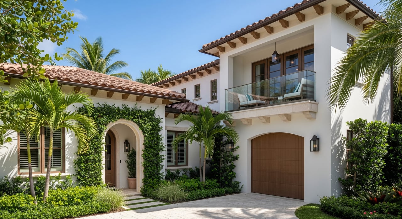
Picture two listings that both promise “gulf access.” One gets you to open water in 15 minutes. The other takes an hour, with shallow spots and a bridge that your boat cannot clear. If you are shopping in Bonita Springs, understanding that difference protects your time, money, and plans on the water.
You want a home that fits your boat and lifestyle, not just a headline. In this guide, you will learn what “gulf access” truly means here, how local canals and tides work, what to verify before you buy, and how access impacts value and resale. You will also leave with a practical checklist and links to trusted sources. Let’s dive in.
What “gulf access” really means
Gulf access typically means a property’s waterway connects to the Gulf of Mexico without passing through a lock. It does not guarantee fast transit, deep water, or easy navigation. Always verify the route, depths, and any restrictions.
Direct or direct gulf access suggests a shorter or less obstructed path to open water or to a marked channel that leads to the Gulf. This term is not standardized. Confirm actual distance, water depth at low tide, and any bridges along the route.
No-bridge to Gulf means there are no fixed or drawbridges between the property and the Gulf. This matters if your boat has a tall air draft, like a sailboat or a flybridge yacht.
Indirect access means you will travel along other canals or the Intracoastal Waterway before reaching a pass. That can still be convenient, but you may encounter bridges, narrow areas, or shallow sections.
You will also see references to private or community canals versus public channels. Private or HOA canals set their own rules and often manage dredging. Public channels are maintained and marked, but depths still vary with tides. Seawalls and docks bring their own costs and permits, which you should review.
Bottom line: MLS language is a starting point. It is not a technical guarantee. Back up any claim with charts, permits, and onsite measurements.
How access works in Bonita Springs
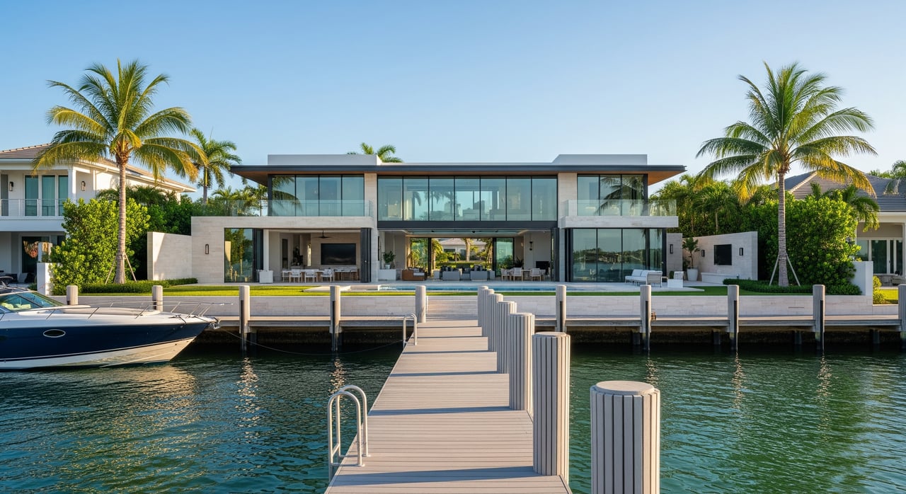
Bonita Springs borders the southeast side of Estero Bay, with routes that lead to the Gulf through nearby tidal passes. Some neighborhoods sit close to wide channels that feed directly into the bay. Others sit along long, narrow canals that take more time to navigate before you reach marked water.
Tides and currents shape your day. Estero Bay and the passes are tidally driven. Depths at low tide can limit draft, and currents strengthen in the passes during tidal changes. Plan your trips using NOAA tide and current tables and confirm charted depths on NOAA nautical charts for Estero Bay.
Bridges may or may not be part of your route. Some are fixed with set vertical clearances. Others may open on a schedule or on request. If your boat is tall, look for no-bridge routes or verify clearances using U.S. Coast Guard bridge regulations.
Canal types vary. You will find natural tidal creeks that were expanded over time, man-made residential canals, and dead-end canals that can make turning larger boats difficult. The width, depth, and presence of a turning basin will influence what size boat actually works.
Match your boat to the water
Water depth and your boat’s draft must align. Compare your boat’s required draft to actual depths at mean low or mean low low water. A route that looks fine at high tide can get skinny at low tide. Charted depths are a guide, but verify with local knowledge and your own measurements at the dock.
Air draft and bridges matter. Fixed bridges impose a hard limit. Drawbridges add time and coordination. If you have a tall sailboat or a flybridge yacht, prioritize no-bridge access or confirm clearances with the Coast Guard and local charts.
Canal width and turning basins affect daily usability. Wider canals and proper turning basins make it easier to dock and maneuver a longer boat. Narrow or dead-end canals can make every trip a test, even if you technically “fit.”
Dock infrastructure and lifts set real limits. Confirm permitted dock length, lift capacity, and the water depth at your dock at low tide. HOA rules or county regulations can limit lift types, boat size, or motor restrictions. Get copies of any permits and approvals.
Remember local rules. Speed zones, no-wake areas, manatee zones, and channel markers are enforced. Review Florida boating rules before you head out. Estero Bay provides shelter compared to open Gulf waters, but you should still watch weather windows, especially for longer runs or overnight trips.
Permits, maintenance, and hazards to budget for
Docks, boatlifts, pilings, seawalls, and dredging usually require permits from multiple agencies. Confirm that existing structures were properly permitted and inspected, and check for any open or expired permits with Lee County Community Development. Shoreline work and dredging may also involve the Florida Department of Environmental Protection and the U.S. Army Corps of Engineers regulatory office.
Dredging and sedimentation change over time. Tidal flats move, especially after storms. Ask when the canal was last dredged, who pays for it, whether there is an HOA or special district, and whether seasonal restrictions apply. County coastal programs can be a resource; review Lee County coastal resources for context.
Seawalls and shoreline protection matter. The age and condition of a seawall affect future costs. Ask for engineering reports or recent repair records if available. If you plan changes, confirm permit paths before you buy.
Flood risk, storm surge, and insurance are part of coastal ownership. Parts of Bonita Springs fall in FEMA flood zones, and flood insurance is often required if you finance the purchase. Windstorm coverage can also affect premiums and deductibles. Check your property’s designation using the FEMA Flood Map Service Center and speak with a local insurance pro who understands coastal Lee County.
If rental income matters to you, verify HOA and local rules on docks, guest boats, and short-term rentals. Some communities set minimum lease periods or prohibit certain uses.
How access affects value and resale
Waterfront homes with direct, no-bridge access often sell at a premium. Many buyers will pay more for shorter transit times, deeper water, and the ability to run a larger or taller boat. That said, the real premium depends on the specifics of the lot, canal, dock, and route.
Details can lower or raise value. Shallow canals, narrow turns, low fixed bridges, or the absence of a turning basin can limit the buyer pool. HOA restrictions, higher insurance costs, and flood zone designations also influence what someone is willing to pay.
Buyer pools differ by lifestyle. Serious boaters with large vessels may focus on no-bridge, deep-water routes. Others simply want a short ride to sandbars, fishing spots, or waterfront dining and do fine with indirect access that suits a center console or skiff.
To price a property correctly, match apples to apples. Use sold comps that share access traits: same canal type and width, similar distance to a marked channel, similar bridge constraints, and comparable dock and lift setups. A local appraiser and a waterfront-focused agent can help quantify the real premium in Bonita Springs.
Buyer checklist for Bonita Springs
Use this list to confirm what “gulf access” means for a specific property before you write an offer.
- Exact route to the Gulf: List the canals and channels you will take, the pass you will use, the distance, and a realistic transit time at your cruising speed.
- Bridges en route: Identify fixed and movable bridges, note the posted vertical clearance, and confirm any opening schedules using U.S. Coast Guard bridge regulations.
- Depths at low tide: Record the water depth at your dock at mean low low water and check typical depths along your route on NOAA nautical charts. Verify with onsite measurements.
- Dock and lift details: Confirm dock dimensions, lift capacity, and copies of permits and inspections. Note any HOA or county rules affecting boat size or lift type.
- Dredging and maintenance: Ask when the canal or channel was last dredged, who pays for maintenance, whether an assessment is planned, and any seasonal work restrictions.
- Seawall condition: Get documentation on age, repairs, and ownership responsibilities for the seawall or shoreline structure.
- Tides and currents: Review NOAA tide and current tables for nearby stations and plan your testing visits at lower tides.
- Flood zone and insurance: Look up the property on the FEMA Flood Map Service Center and get quotes from a local insurance agent experienced in coastal Lee County.
- Environmental rules: Verify mangrove protection and any shoreline work requirements with Florida Department of Environmental Protection and county staff.
- Permits and records: Check for open or expired permits with Lee County Community Development and ask about any prior violations.
Recommended professional help:
- Marine surveyor or dock contractor to inspect docks, lifts, and depths at the property.
- Seawall or coastal engineer for shoreline structures.
- Local harbormaster or marina operator for practical navigation advice and service availability.
- Insurance agent with coastal experience in Lee County.
- Local real estate appraiser for waterfront valuation.
Next steps
If you love boating, the right Bonita Springs home can be a launchpad for your best days on the water. The key is to match your boat and lifestyle to a verified route, with clear permits and realistic ownership costs. When you are ready to evaluate a specific home or canal, we can help you compare depths, bridges, and neighborhood rules so your decision is simple and confident.
Have questions about a listing’s access, or want a short list of properties that fit your boat? Reach out to The Cassidy Team for local guidance and a focused search.
FAQs
What does “gulf access” mean for a Bonita Springs home?
- It means the property connects by water to the Gulf of Mexico without a lock, but it does not guarantee fast transit, deep water, or no bridges. Verify the actual route, depths at low tide, and bridges before you buy.
How can I check tides and depths near a Bonita Springs property?
- Use NOAA tide and current tables and review NOAA nautical charts for charted depths, then confirm at the dock during low tide with a measurement.
Why do bridges matter for gulf access in Bonita Springs?
- Bridges limit air draft for tall boats and can add time if they are drawbridges. Confirm vertical clearances and opening details through U.S. Coast Guard bridge regulations.
What permits should I see for docks, lifts, or seawalls?
- Ask for permit and inspection records from Lee County Community Development. Shoreline work and dredging may also involve the Florida Department of Environmental Protection and the U.S. Army Corps of Engineers regulatory office.
How does flood risk affect insurance for waterfront homes?
- Many coastal areas fall within FEMA flood zones, which can require flood insurance for financed purchases. Check your property’s flood zone on the FEMA Flood Map Service Center and get quotes from a local agent.